 March 22, 2017. (Updated April 21, 2017). Bruce Riesterer, Resource Conservationist at the Manitowoc County Soil and Water Conservation Department, has created a new, interactive, watershed mapping tool.
Visit http://manitowoc.maps.arcgis.com/apps/View/index.html?appid=c38b2149d3b947eb9bd120f5480c4a1e to use it to view your lake’s watershed.
Private and public lake watersheds are displayed, with a choice of base maps that includes terrain, street maps, satellite and others.
The new mapping shows the watershed land area and boundaries quite clearly. Because the water quality of each lake is affected by things happening in this area, this new level of precision is quite helpful!
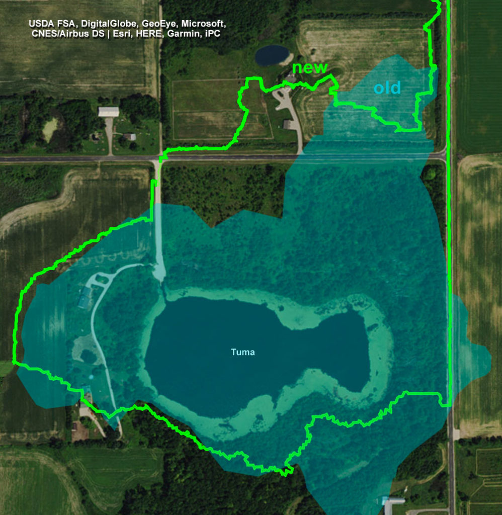
To the right is a great example of the new level of detail this tool provides, as evidenced by the watershed boundaries for Tuma Lake. The light blue area is the watershed according to previous maps. The bright green is the watershed as drawn by the new mapping tool.
The boundaries are now more accurate because of new lidar-generated elevation data recently made available.
On the actual mapping tool website (http://manitowoc.maps.arcgis.com/apps/View/index.html?appid=c38b2149d3b947eb9bd120f5480c4a1e) the user can zoom in to show an extreme level of detail, as shown in the second image.
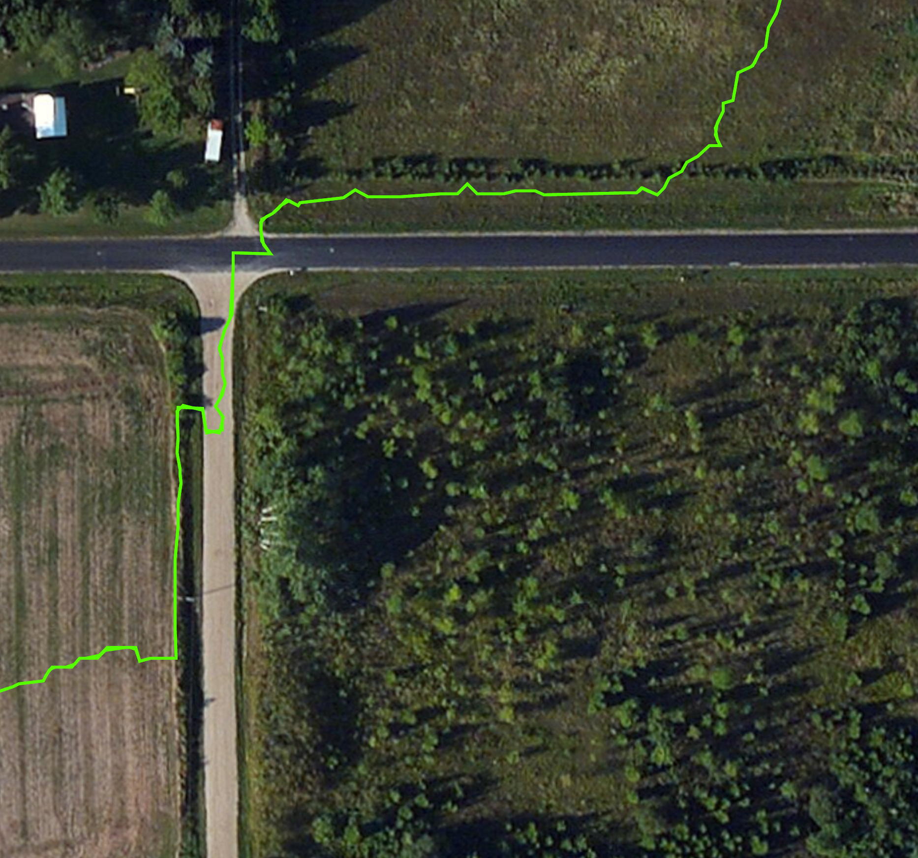
Detail of watershed boundary of Tuma Lake.
Bruce asks that people take a look at the watershed for their lake(s) and let him know immediately if they see something that doesn’t seem accurate (e.g., placement of culverts).
You can contact him at bruceriesterer@co.manitowoc.wi.us
Map images ©2017 Manitowoc County Soil & Water Conservation Department